Research project · Work in progress
The MURO Project
Mapping Urban Regulation Over time in Developing Countries

Regulation plays a big role in how cities evolve over time: it shapes what can be built and where. Yet we know much less about how cities are regulated in developing countries, and almost nothing about how that regulation changed, especially over long periods of time.
The MURO project (Mapping Urban Regulation Over time) is our attempt to fill that gap. Muro is Spanish for “wall”: the limits and direction that regulation sets on how a city grows.
Historical regulatory documents do exist. Municipal land-use plans, zoning maps and ordinances record how land use was regulated, or left unregulated, in each period. However, they are held in archives as paper maps and scanned documents, and they have not been converted into data that can be analysed. Recent advances in large language models have substantially reduced the time and cost of processing this material.
We have assembled a team of economists, data scientists and geographers to do it with large language models, with experts reviewing the results. We start with Chile and are building the process so it can be repeated in other countries.
Status Preliminary. This page describes the method. No data is released yet.
What we do
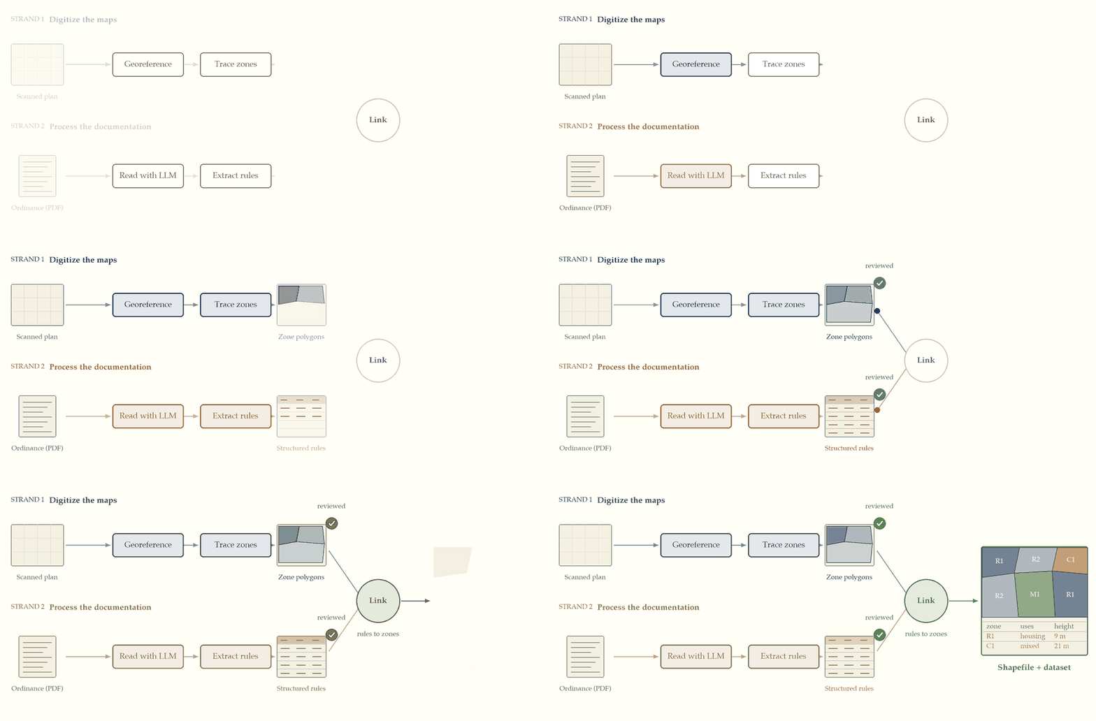
The historical record is unstructured. The maps come as image files and PDFs. The written regulation is readable, but it follows no common guideline: its format and wording vary between regulators and between municipalities, and even within the same municipality over time. Using language models with humans in the loop, we process both to produce readable shapefiles and datasets that are ready to be analysed.
1. Digitize and georeference old maps
Historical zoning plans survive as scans and drawings. We place each sheet on the ground, trace the zones it defines, and give every zone the code printed in its legend. Each new plan modifies an earlier one, so we update the previous map instead of redrawing the city from scratch, and we end up with a map of the rules for each year.
2. Read the documentation with language models
The maps tell us where a zone is; the written ordinances tell us what it allows. Language models read these documents and pull out the rules, such as permitted uses, heights and densities, into structured fields we can analyse. These fields are then linked to the zones on the map.
Sources
- Written regulation (PDF and text). The Biblioteca del Congreso Nacional de Chile (Ley Chile) and the Ministerio de Vivienda y Urbanismo (MINVU). Example: Resolución No. 11 (1990), which approves the modification of the Valparaíso plan for the area around the National Congress. It accompanies the map in Figure 1.
- Plan maps. Maps delivered by the municipalities, and other MINVU sources.
Team and affiliations
Principal investigators
 Raimundo Undurraga Assistant Professor, Department of Industrial Engineering, Universidad de Chile Website

Collaborators
Data
Coming soon.
Code
Coming soon.
Acknowledgments
We thank the support of Núcleo Milenio Migra.